 Geobru catalogue
Keyword
land planning
Type of resources
Available actions
Topics
INSPIRE themes
Keywords
Contact for the resource
Provided by
Years
Formats
Representation types
Update frequencies
status
Resolution
From
1
-
1
/
1
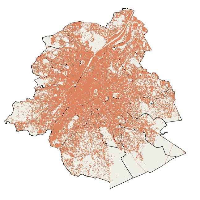
-
This map indicates the impervious surfaces where rainwater cannot or hardly infiltrate into the soil for the year 2022. Impervious surfaces are: artificial sealed surfaces (such as streets, squares, car parks ...), buildings and compact soils. Permeable surfaces are vegetation-covered soils, bare soils and water areas. Railway areas are permeable or impermeable depending on the type of cover. The map was compiled from satellite images (Sentinel -2) and orthophotos (from UrbIS and Digitaal Vlaanderen) with a final resolution of 1m.